Urban GIS: Mapping Access to Early Childhood Education
My Urban GIS class produced an analysis of city-wide early education access in partnership with the Saint Paul city council.
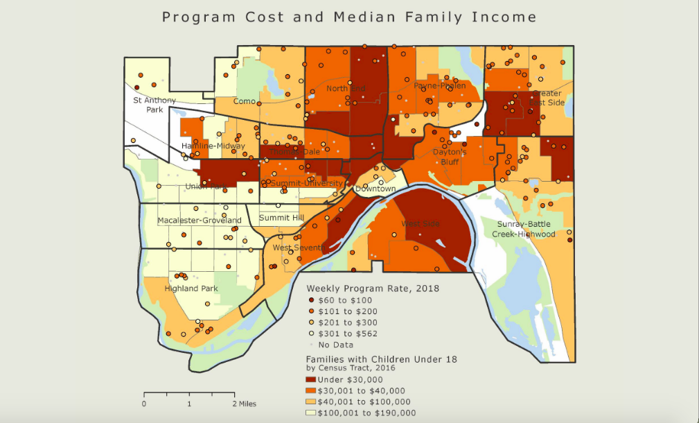
Our class partnered with City Councilmember Rebecca Noecker in support of the proposed Saint Paul 3K Initiative, designed to provide equitable access to affordable, high-quality preschool for all three- and four-year old children in Saint Paul. We created a series of maps identifying areas of demographic need and potential barriers to program access.
These maps are featured in our interactive ArcGIS Story Map. We also created an interactive program-mapping app, which allows users to filter our childcare program data according to their preferences.
It was exciting to produce maps that informed to ongoing policy efforts, and to share our findings with key decision-makers in Saint Paul education policy.
This project was my first opportunity to get familiar with ArcGIS Pro, as well as an opportunity to continue building on my experience with ArcGIS Story Maps and web apps.