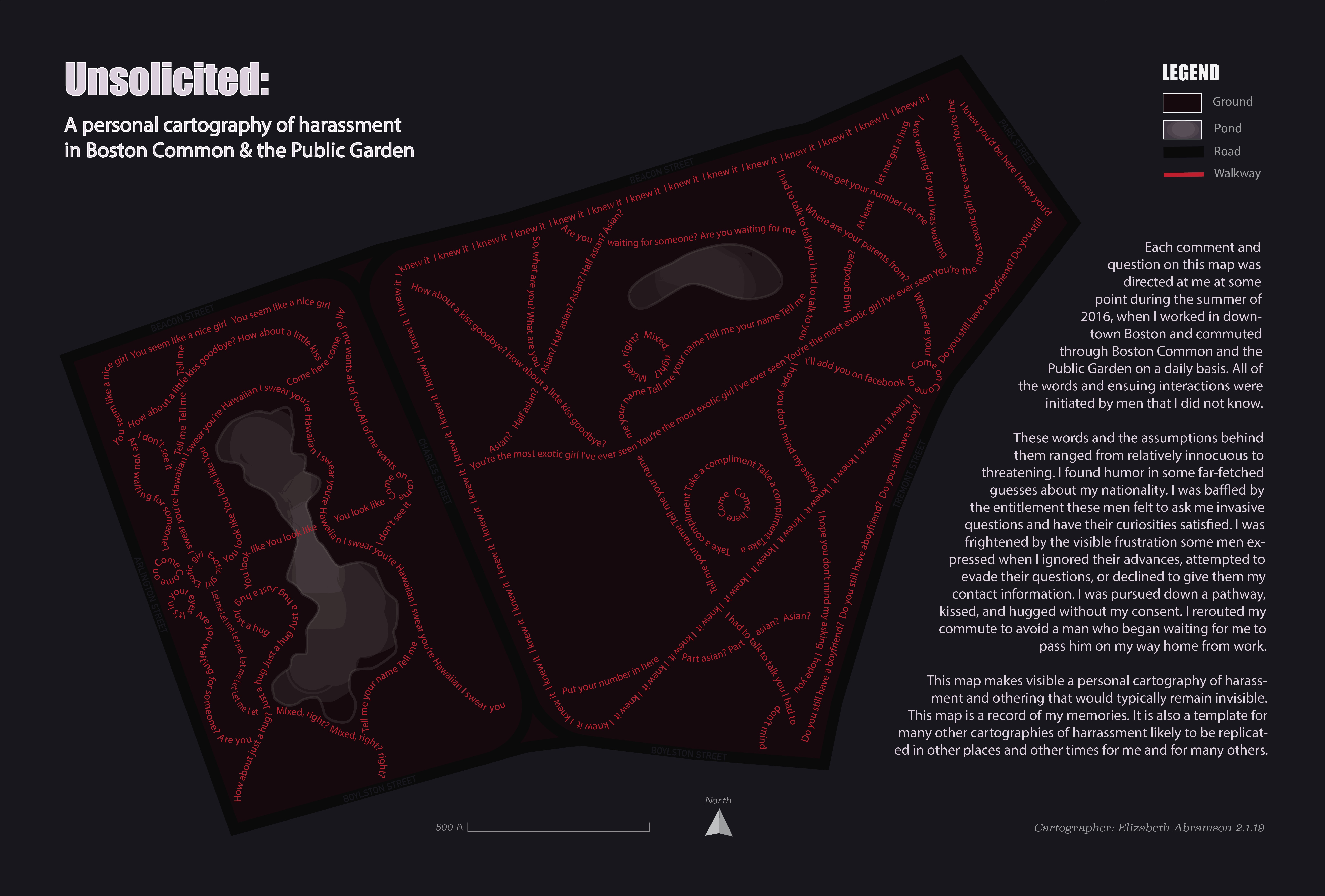
Unsolicited: A Personal Cartography of Harassment in Boston Common & the Public Garden
I created this map and layout as a personal project focusing on critical cartography.
In this map, the pathways of Boston Common and the Boston Public Garden are overlaid with comments and questions I received while walking through or sitting in these public spaces during the summer of 2016. While maintaining the general form of walkways and the geographic boundaries of the Common and Public Garden, this project challenges traditional notions of what a map is for.
This map makes visible a series of interactions that would be imperceptible to the objective cartographic eye, but which perpetually frame my memories of that space. The map documents just one way that public spaces like the Common and Public Garden can quickly and invisibly become sites of hostility and othering.
Depicting these numerous entangled comments and questions as a cohesive whole makes clear that the words themselves and the assumptions behind them are evidence of larger systemic issues, rather than being a series of isolated incidents.
Zoom in to see the details of the layout.
This map and layout were made using Adobe Illustrator.