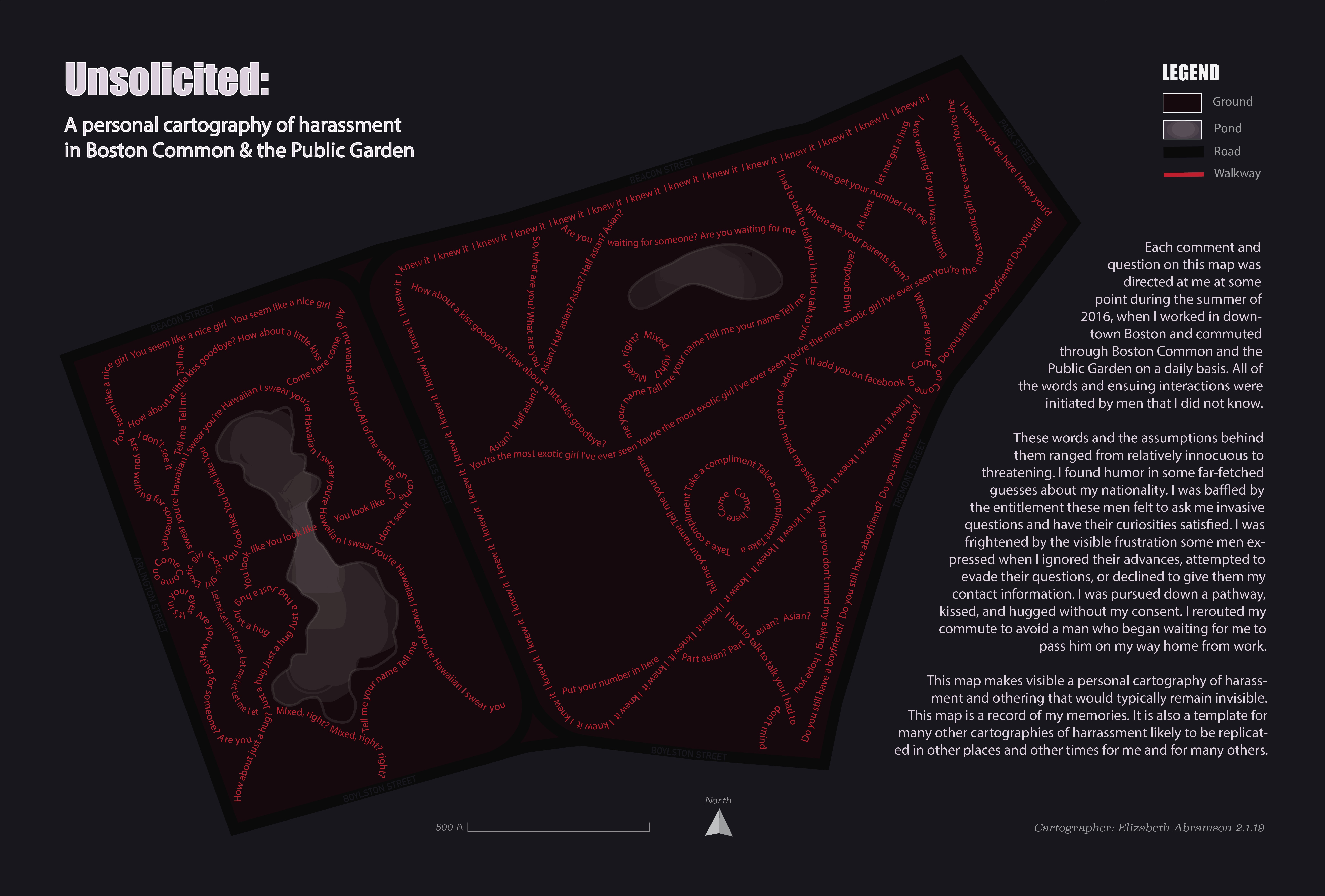
Unsolicited: A Personal Cartography of Harassment in Boston Common & the Public Garden
I created this map and layout as a personal project focusing on critical cartography.
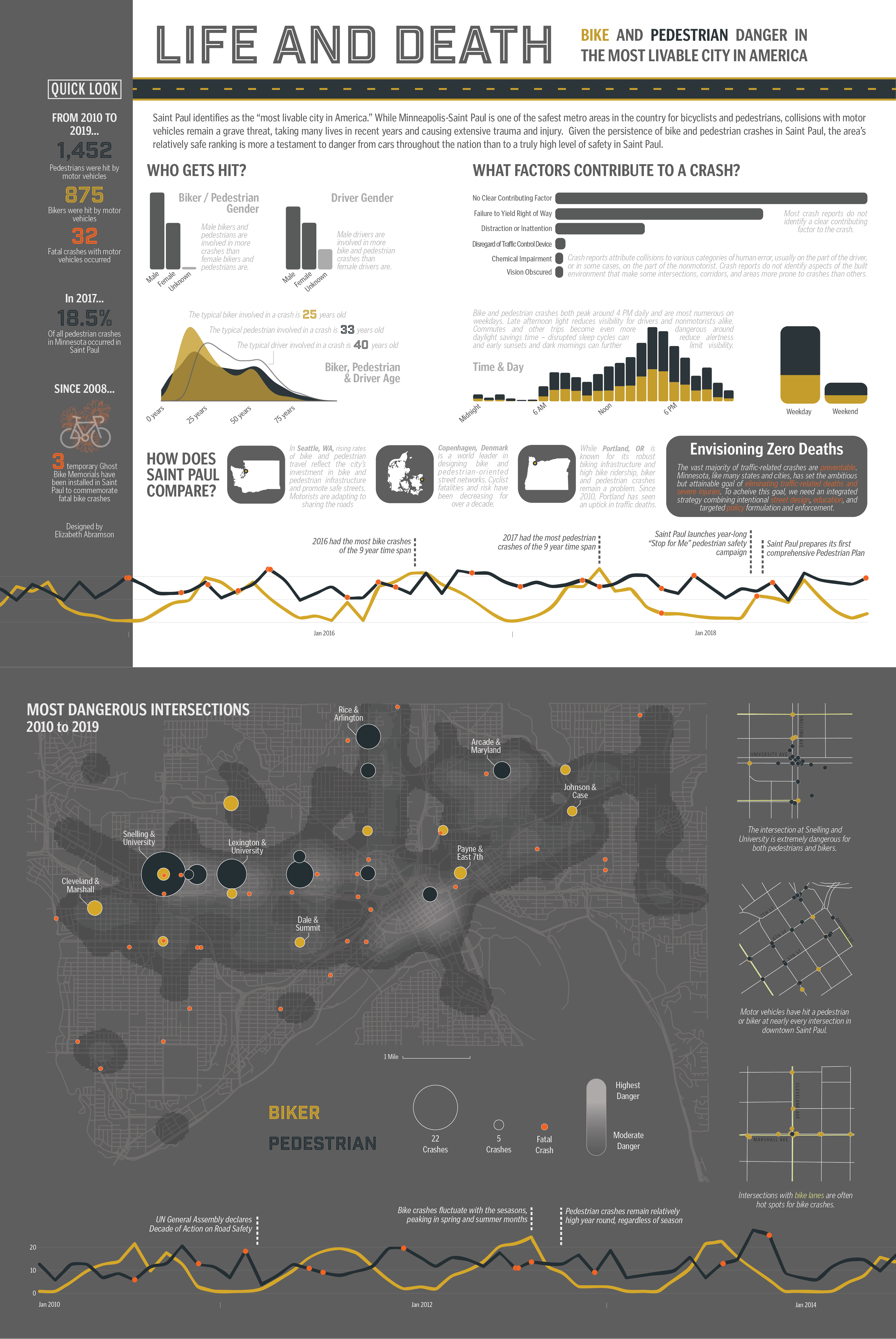
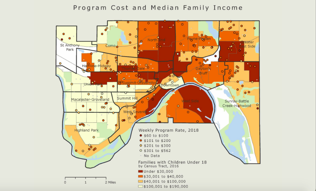
Spatial Analysis and Information Design: Tracking Bike and Pedestrian Danger
I analyzed nearly a decade of bike and pedestrian crashes to provide insight into crash factors and consequences in Saint Paul, MN.
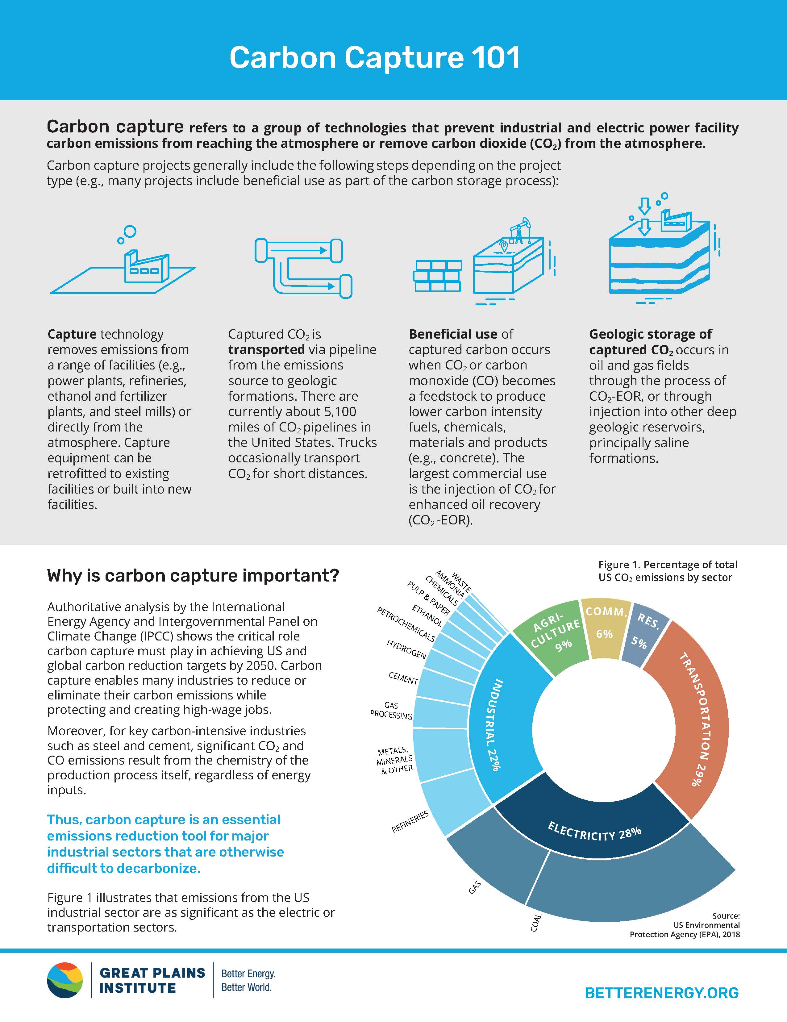
Carbon Capture 101
I worked with colleagues at the Great Plains Institute to create this visual introduction to Carbon Capture technology and policy.
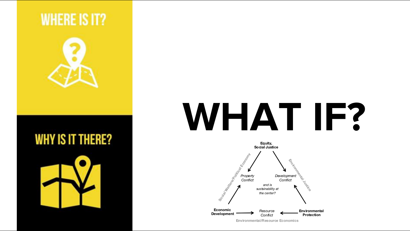
Planning for Racial Equity in Brightfield Development: Lessons from Scituate, MA
I spent the fall semester of my Senior year researching a case study of solar-on-landfill or “brightfield” solar development.
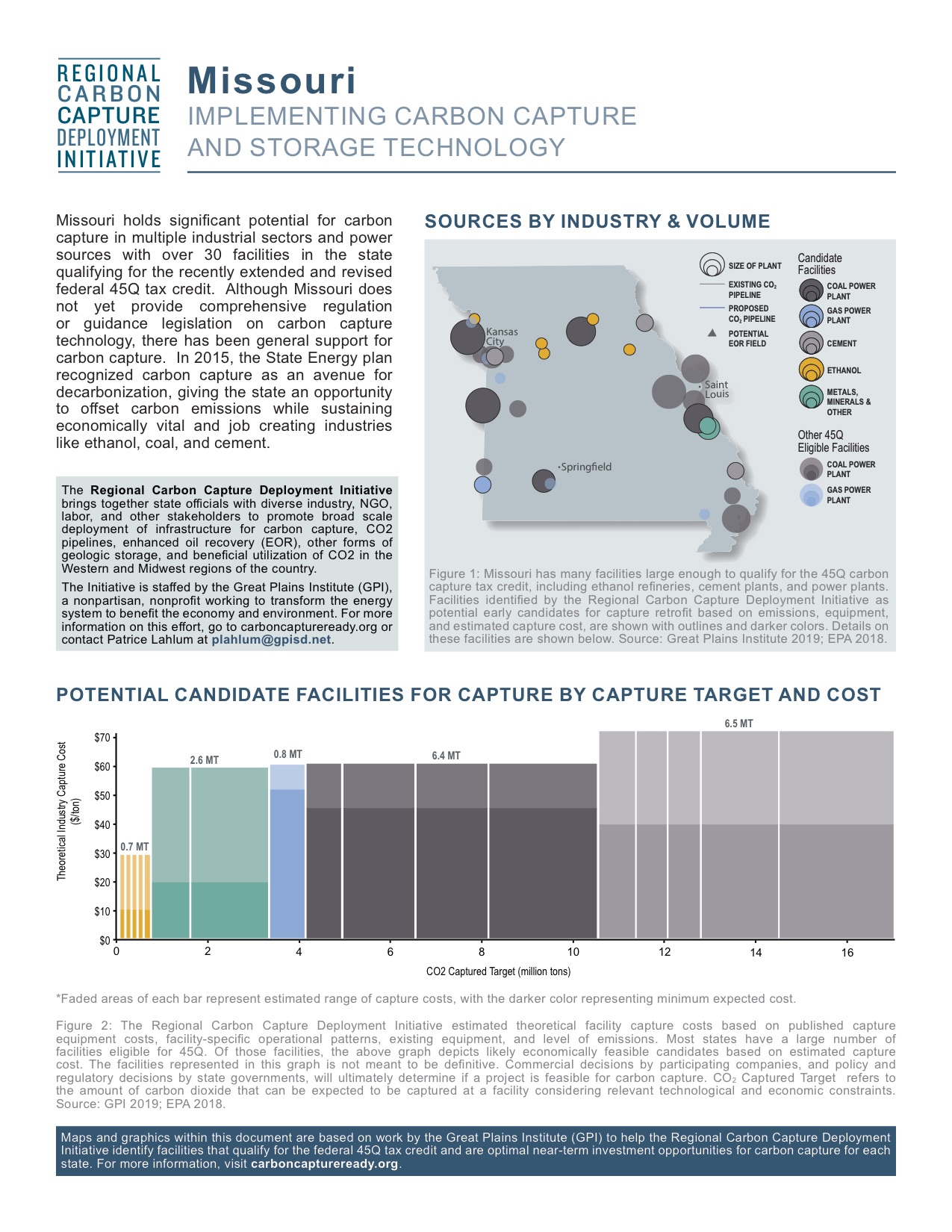
Regional Carbon Capture Initiative State Fact Sheets
I conducted an extensive analysis of US Greenhouse Gas emitters, assisted in identifying key opportunities for carbon capture deployment, and designed the layout and graphics for a series of state fact sheets, distributed to key regional and national stakeholders.
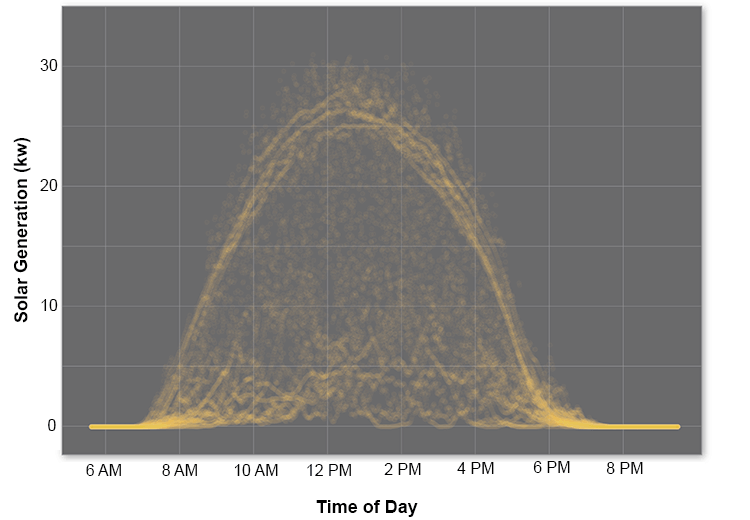
Analysis of Rooftop Solar Generation
I analyzed a year’s worth of minute-by-minute data to assess the seasonal reliability of rooftop solar, using EV charging as an end-use test case.
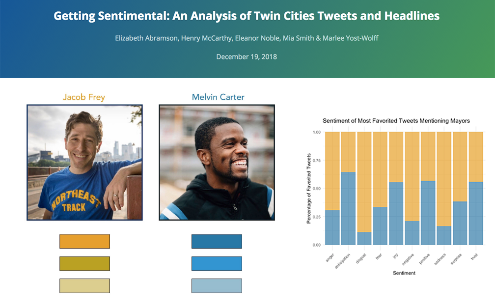
Getting Sentimental: An Analysis of Twin Cities Tweets and Headlines
I worked with classmates to produce this sentiment analysis of local news headlines and tweets.
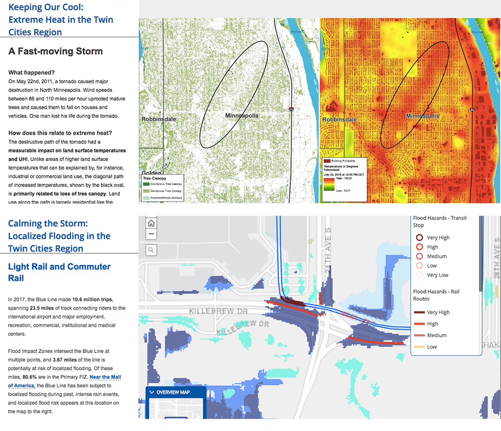
Climate Vulnerability and Resilience Mapping
Contributing to these ArcGIS Story Maps was a highlight of my internship with the Metropolitan Council.
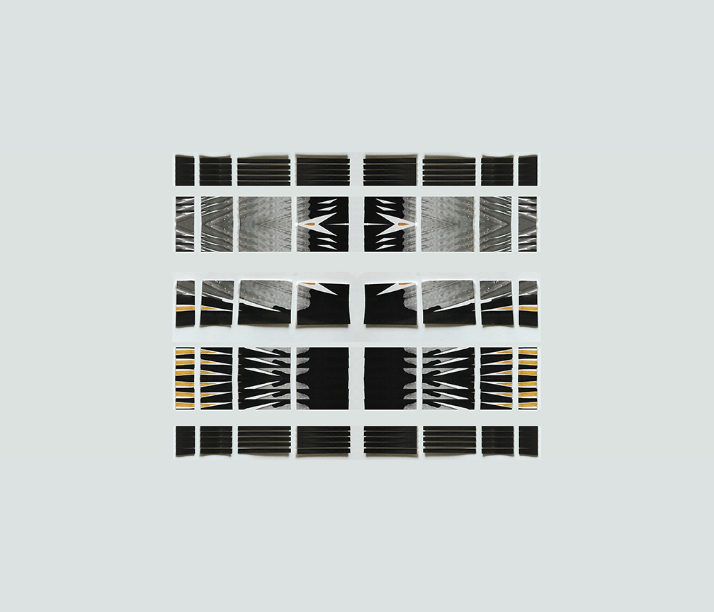
Mixed Media
I created these works of mixed media art as explorations of color, shape, and depth.
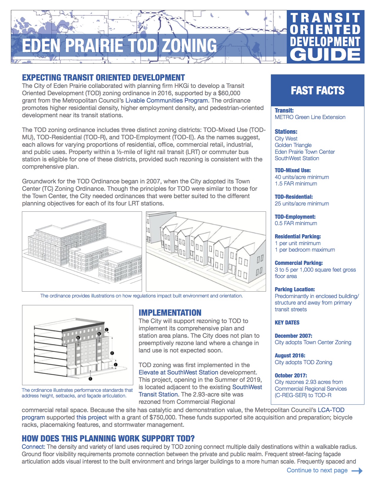
Transit Oriented Development Guide
During my internship with the Metropolitan Council, I had the opportunity to work on the Transit-Oriented Development “TOD” Guide, a resource for local planners, elected officials, planning commissioners, and others to learn about planning for and implementing TOD.
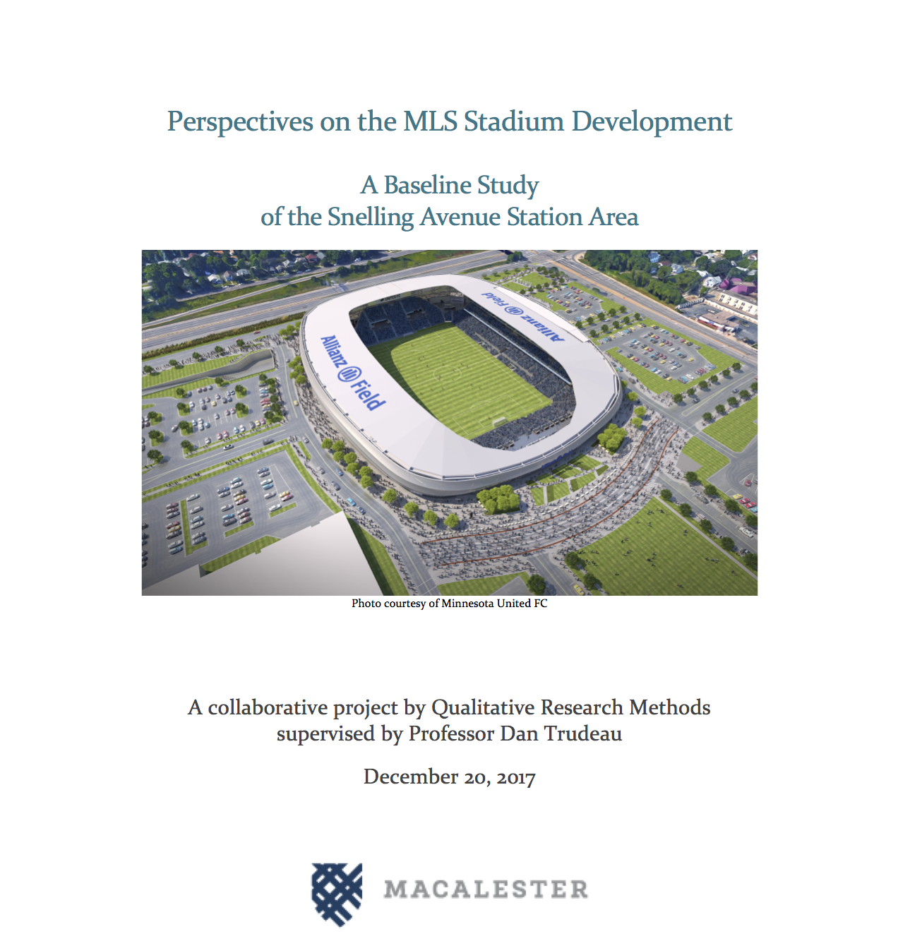
Community Perspectives on Stadium Development
For my Qualitative Research Methods class I interviewed local residents, business owners, and organization leaders to document their perspectives on the introduction of a Major League Soccer stadium in the neighborhood.
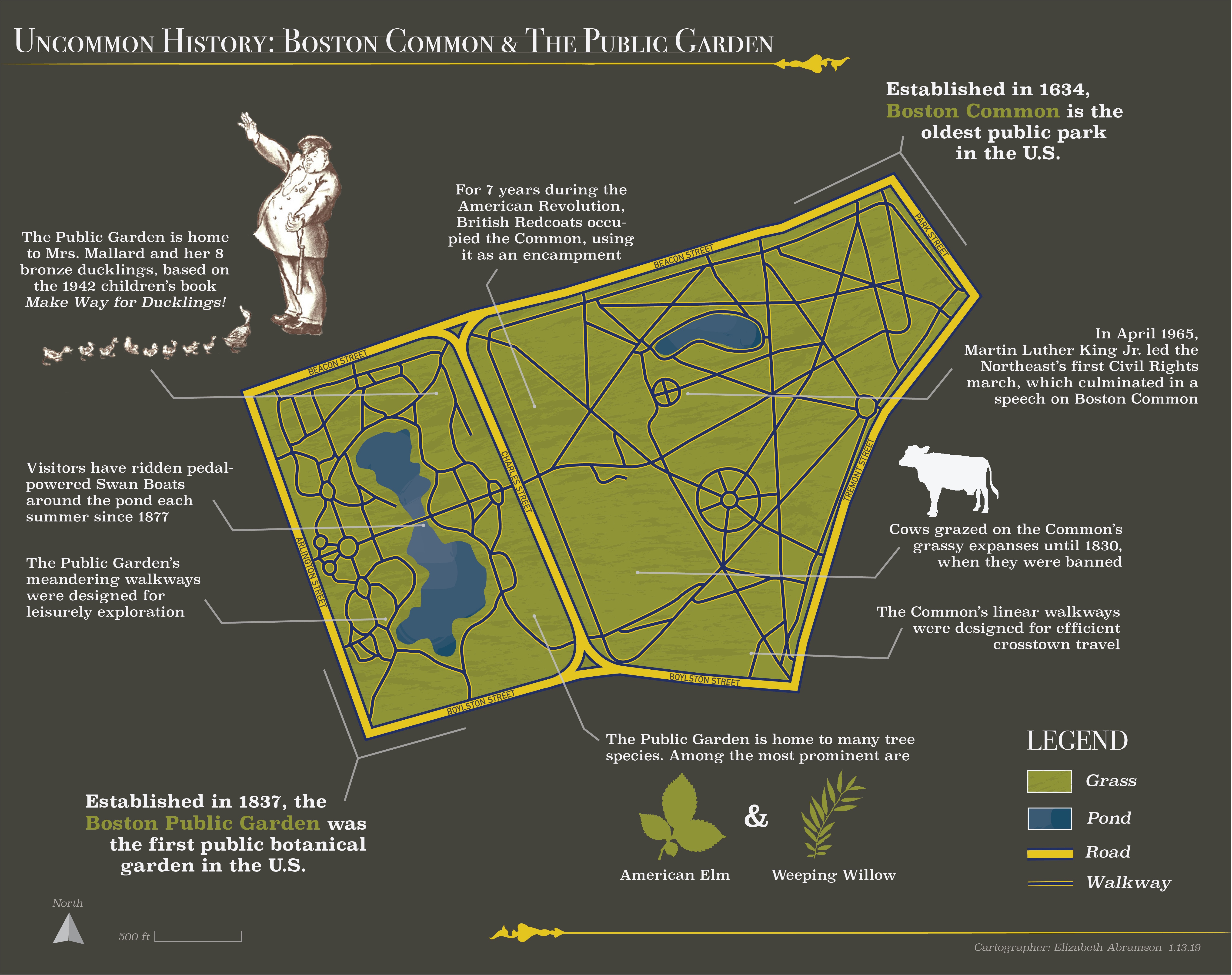
Uncommon History: Boston Common & the Public Garden
Making this map gave me the chance to explore Adobe Photoshop and Illustrator, and to learn more about the history of my hometown.
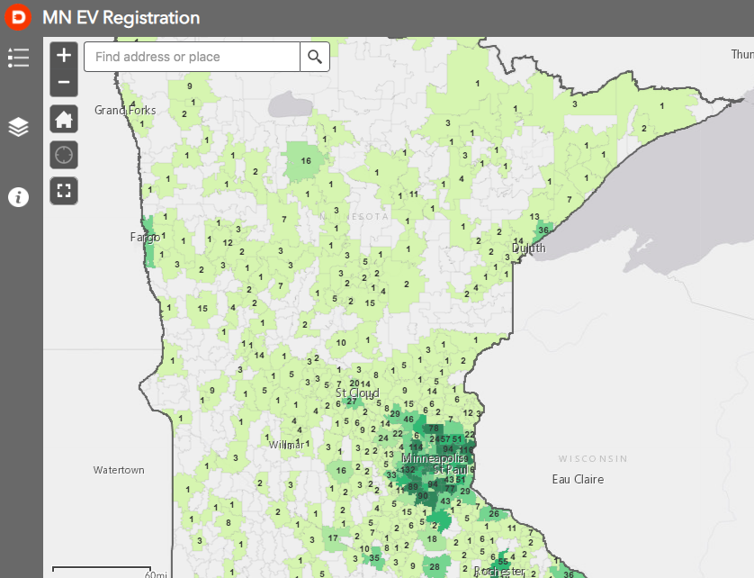
Electric Vehicle Data Tracking
I produced interactive maps and reported on data trends in Electric Vehicle registration in Minnesota.
Analyzing the Sustainability of a Coastal Spanish City
While studying abroad in Granada, Spain, I enrolled in a class at the University of Granada focused on the sustainable planning and management of urban spaces.

A First Foray into Animation with Photoshop
I used Adobe Photoshop to create an original GIF.
Urban GIS: Mapping Access to Early Childhood Education
My Urban GIS class produced an analysis of city-wide early education access in partnership with the Saint Paul city council.
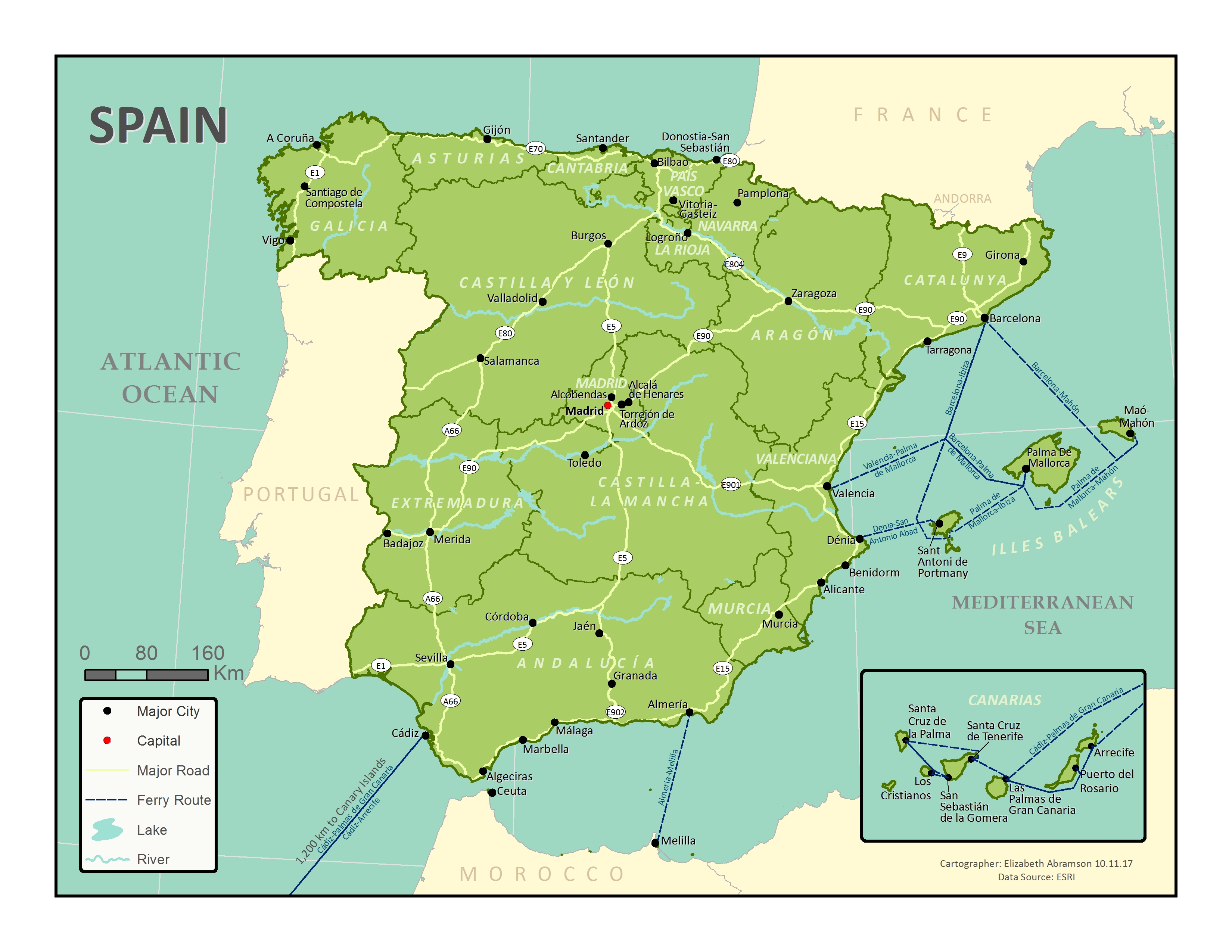
Reference Mapping
I created this reference map of Spain for my intro GIS class the semester before I studied abroad in Granada, Spain.
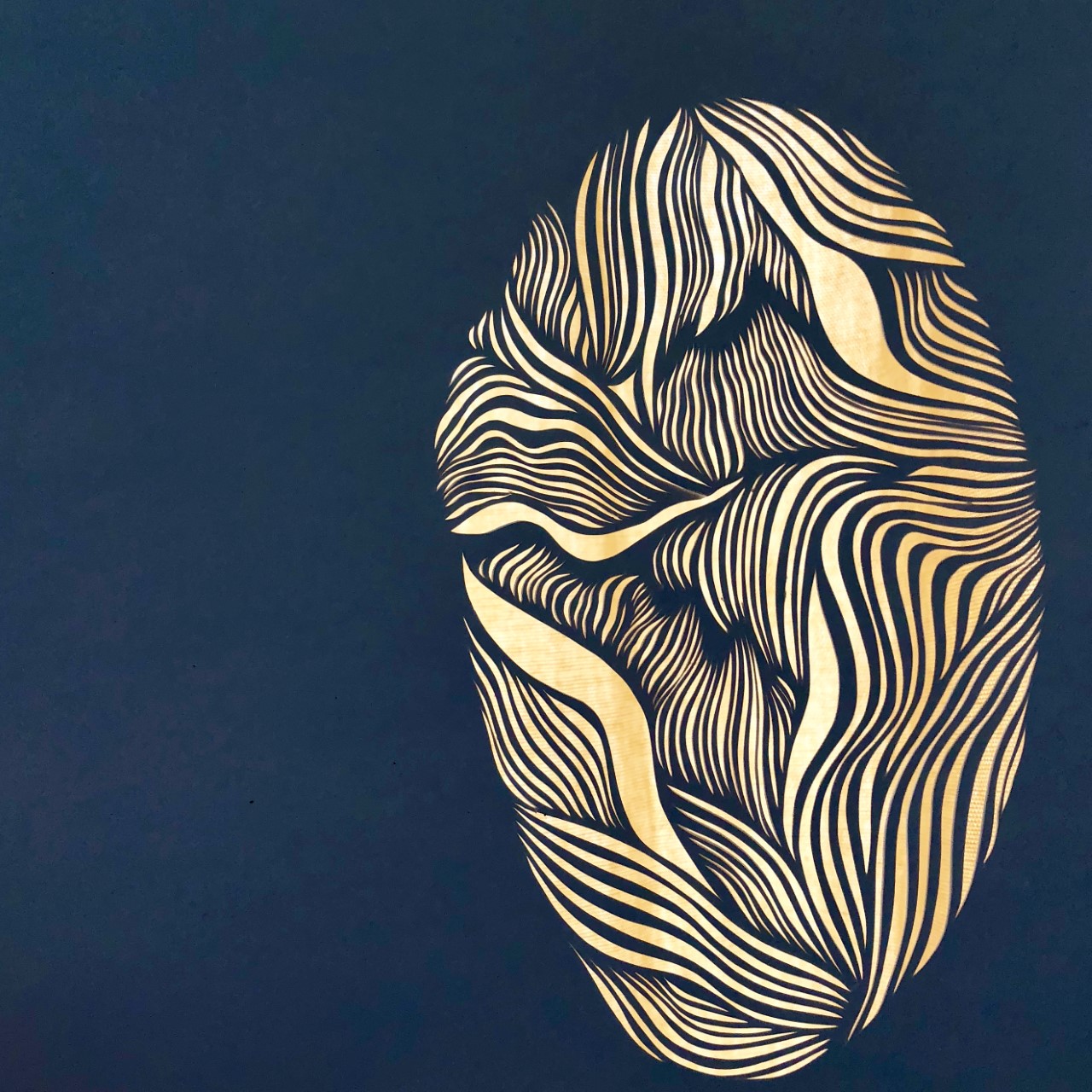
Papercutting
I use an x-acto knife to create these hand-made works of art.